
Bensalem Township Neighbors: Block Record Sources
The nearby Bensalem Township block is best understood through a small set of record types, each with a distinct job. The county parcel layer supplies geography. The tax and assessment paths supply parcel-centered owner or mailing information. The Recorder supplies transactions for one parcel at a time. A polling-place list supplies civic geography, while local repositories supply historical context. None of these sources is an official roster of every household on a block.
| Source | What It Shows About a Block | Access |
|---|---|---|
| County GIS parcels | Parcel geography and nearby boundaries | Maps & Data and county parcel layer |
| Tax and assessment record | Parcel, named owner, and tax-mailing context | Public form, assessment system, or counter |
| Recorder chain | Recorded parties and transactions for a particular parcel | LANDEX or Recorder research room |
| Address request | Adjacent-number and addressing context | Building and Planning form and staff |
| Polling-place list | Precinct and civic geography | County public web list |
| Historical repositories | Historic place, family, and property context | On-site research or a specific request |
The Bucks County Tax Claim Public Access form is one starting point for a known Bensalem Township address. It separates Location Address from Mailing Address, City, and ZIP Code, which keeps a mail destination from being mistaken for the property itself.
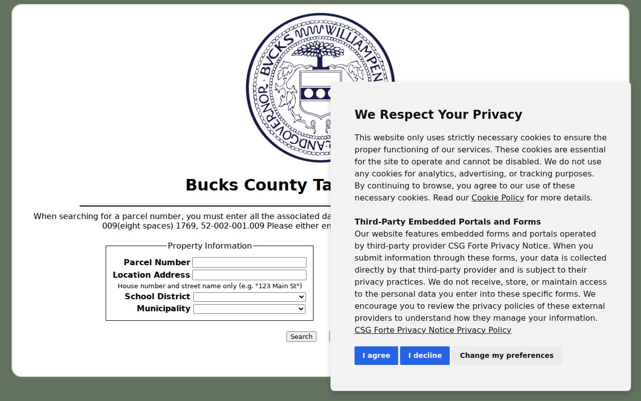
Its form accepts parcel number, location address, owner name, municipality, and mailing fields. Select Bensalem Twp when appropriate and keep the returned parcel identifier for the next source.
Map Bensalem Township Neighbors Parcel by Parcel
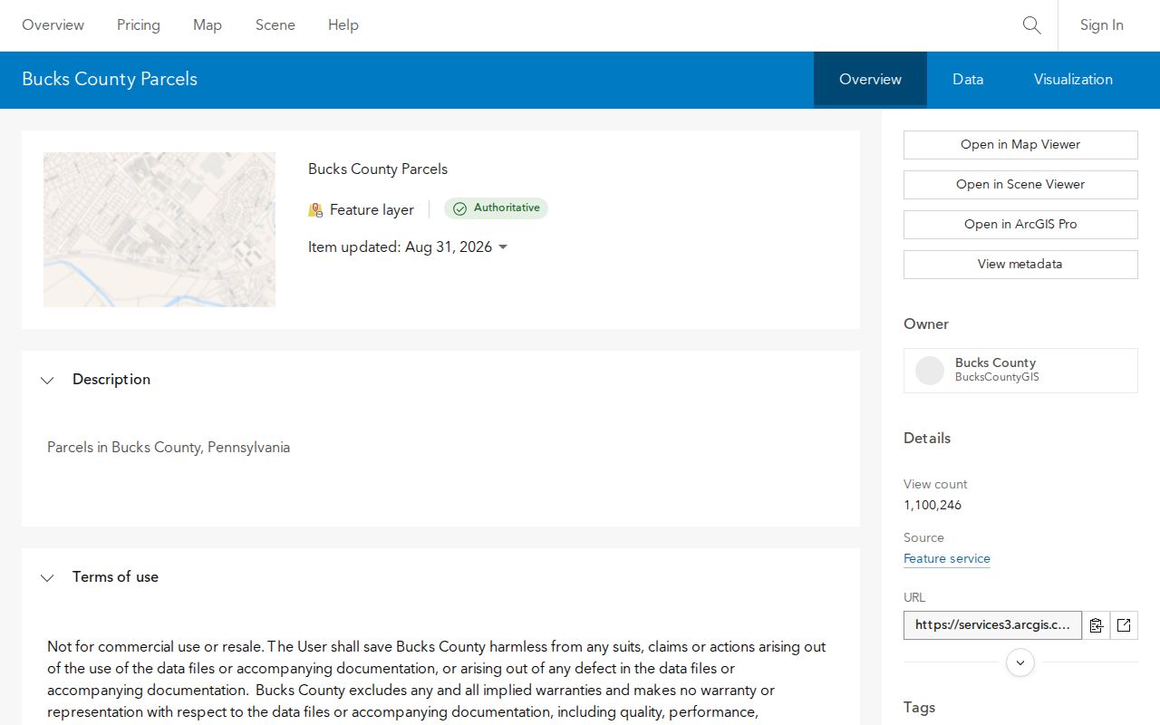
Begin at the focal parcel, then work outward. The county’s public parcel item supports map browsing and visual identification of boundaries. The research did not capture live viewer control labels, layer menus, buffer buttons, measurement tools, or pop-up fields. The supported method is therefore a careful map browse followed by parcel-number verification in the tax or assessment system, not a claim that the map provides a one-click neighbor list.
- Open the focal address in the county map and identify its parcel outline without treating the visual edge as a legal boundary determination.
- Record the parcel number from the tax or assessment path, then note the parcels that share a boundary or sit across the public street.
- Run each nearby parcel number through the property route. Log the source date, legal description or plan lot, named owner or tax-mailing field, and any current Recorder instrument separately.
- Use a deed’s prior reference only for that parcel’s transaction trail. For a complete named-street method, use the Bensalem Township street directory record chain.
The county-published Bucks parcels item supplies the map layer captured in the image. The tax and assessment systems supply the corroborating record.
Retain a row for each parcel rather than merging similar numbers, units, or mailing addresses. This produces a block geography with evidence, not a private household roster.
Bensalem Township Parcel Evidence Has Limits
A parcel record can identify a named owner or tax-mailing contact. A deed can identify recorded parties, a date, and a legal description. A municipal permit or zoning file can show a property-focused administrative event. None of those records establishes every person connected to the address. The Board of Assessment also cautions that its online ownership information can lag a newly recorded deed, so a date-sensitive finding should be checked against the Recorder.
Nearby Bensalem Township parcels may also be obscured by postal and community labels. Township history says former communities were brought under a Bensalem postal identity in 1979. A record can use Bensalem, Trevose, Cornwells Heights, Eddington, Andalusia, or another local label. Preserve the municipal label, postal city and ZIP, parcel number, street name, and historic community name together. That combination is more reliable than assuming one mailing line describes every record made for the same place.
Evidence label. Describe a finding as an adjacent-parcel owner, tax-mailing contact, recorded party, or permit addressee. Those labels preserve the difference between a record and a claim about a household.
Bensalem Township Neighboring Numbers in Address Requests
The Township’s address-request application shows how closely Bensalem Township treats an address and its surrounding numbers. For one property, it asks for the tax parcel number, street, nearest intersecting street, adjacent house number, and a sketch. The instructions call for north and south addresses as well as addresses across the street. The completed request then has review fields for Township Fire Rescue, Bucks County Board of Assessment, Bucks County 911, and the Post Office.
Submit an identified request to Building and Planning at the Township Municipal Building or through its published permit-center email. This is an address-assignment and continuity path, not a way to seek names tied to nearby homes. The separate Township research-request PDF was not text-inspectable in the research, so its form fields, price, timing, and submission checklist are not claimed here.
Note: When the address itself is uncertain, the parcel, intersection, nearby numbers, and sketch are stronger starting facts than a broad request for people.
Bensalem Township Neighbors and Civic Geography
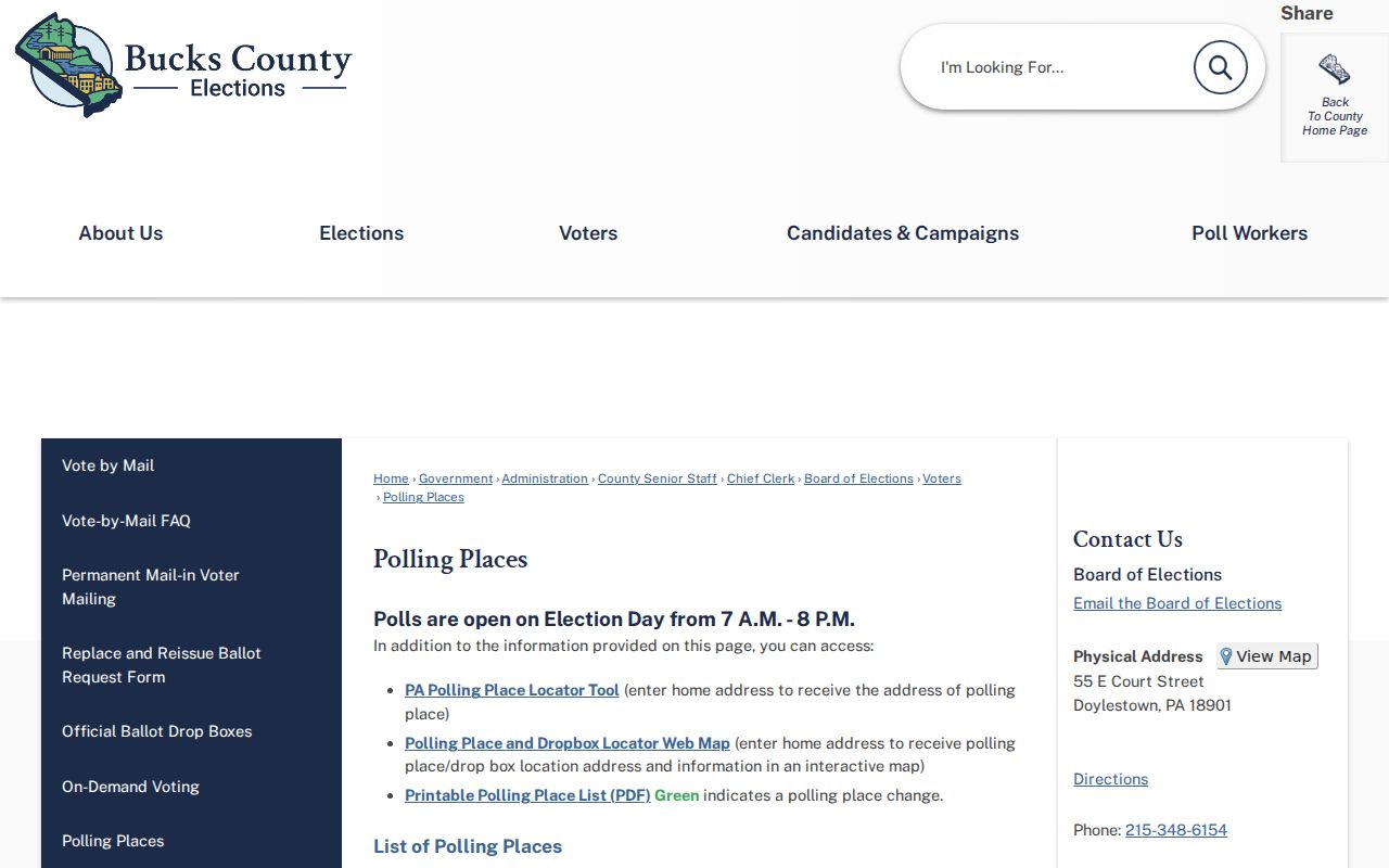
Election geography can help place a Bensalem Township address in a precinct without naming individual voters. Bucks County’s polling-place list includes Bensalem labels such as Lower East, Lower Middle, Upper West, and Upper precincts. It also shows that Township precinct rows can use Bensalem 19020 or Trevose 19053 as the postal city and ZIP. A postal label therefore needs a parcel or precinct check before it is used as a municipal conclusion.
The Bucks County polling-place list supplies the precinct source captured in the image. It locates precincts and polling places without exposing individual voter names.
Pennsylvania’s Street List and Walking List are controlled official requests with a use affirmation. They support permitted election-oriented, political, or law-enforcement uses and cannot be treated as material for mass neighbor lookup or internet publication. Safe at Home participants remain protected.
Bensalem Township Neighbors in Historical Collections
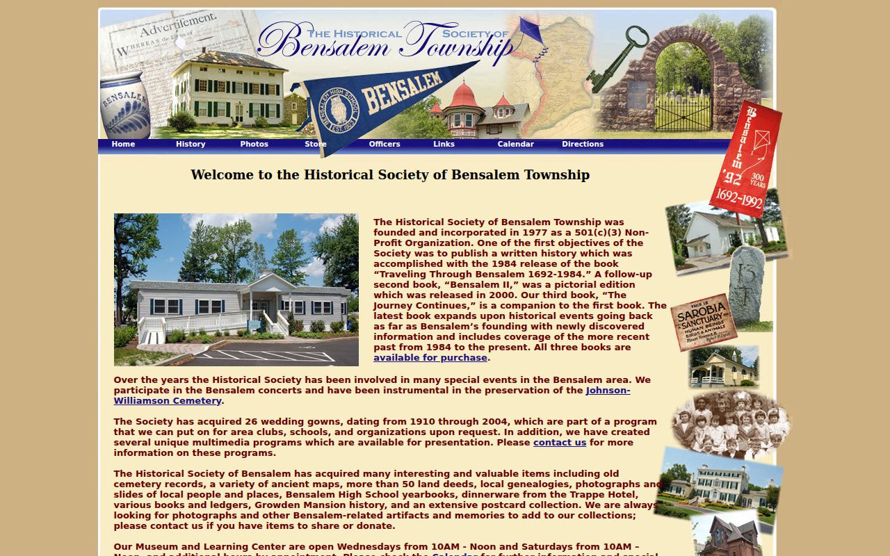
For a historic block question, the Historical Society of Bensalem Township is the local collection to contact. It holds deeds, cemetery records, maps, local genealogies, Bensalem High School yearbooks, photographs, ledgers, and house-history material. The University of Pennsylvania finding aid describes 36 linear feet of subject files from about 1900 through 2013, including real-estate files, 1958–59 Township photographs, house histories, and a 1937 senior-name-card scrapbook. These sources can put a street or community in context, but they do not identify current neighbors.
| Repository | Historically verified material and contact path |
|---|---|
| Historical Society of Bensalem Township | 3211 Knights Road, Bensalem PA 19020; 215-639-6575; Wednesday and Saturday 10:00 a.m. to noon, and by appointment. Ask about deeds, maps, yearbooks, house files, or the applicable community. |
| Mercer Museum Research Library | County archives, maps, manuscript collections, and historical indexes at 84 S. Pine Street, Doylestown. Its research-by-mail service provides targeted citations but does not conduct chain-of-title research by mail. |
| Bensalem Branch, Bucks County Free Library | 3700 Hulmeville Road; 215-638-2030. Ask staff to check a particular street, historic community, year, directory, telephone book, or genealogy database. |
The Historical Society of Bensalem Township offers an on-site, source-based route to Bensalem Township neighborhood history rather than an online membership directory.
Request a specific folder, street, community label, or time span. That gives staff a workable historical question and avoids assuming an older photograph, yearbook, or file identifies a current household.
No Public Bensalem Township HOA Roster
No authoritative public Bensalem Township HOA, association-member, or township-wide community-membership directory was found in the research. Township boards, commissions, agendas, and contact information are public civic sources, but they are not neighbor rosters. A historical club or association lead belongs with the Historical Society, Mercer, or a direct question to the named group about a voluntary public contact page.
This gap matters because a block page should not turn a public meeting record or historic collection into a present membership claim. The right Bensalem Township record path is parcel, transaction, civic geography, or documented historical context, depending on the question.
Bensalem Township Neighbor Tools Compared
Official sources and commercial neighbor tools do not carry the same evidence weight. County sources expose a limited, record-specific fact that can be checked with the office that keeps it. Commercial tools may mix data from many sources, with unclear refresh dates and matching methods. Neither category should be treated as proof of a household composition.
| Category | Useful for | Boundary |
|---|---|---|
| Official parcel, tax, Recorder, and precinct records | Parcel geography, recorded transactions, tax-mailing context, and civic district | Each record has a stated scope and custodian. |
| Commercial neighbor tools | Possible lead that requires independent checking | Coverage, accuracy, source date, and protected-address handling are not official proof. |
The practical choice for Bensalem Township neighbors is to retain the parcel number and source date, then ask the responsible office about a defined record. That leaves a clear trail when information changes.
Privacy Limits for Bensalem Township Neighbors
Pennsylvania protection is record-specific. The Right-to-Know Law exempts many personal identifiers and financial details. Vital records have their own confidentiality rules, and voter data has strict use and publication limits. The Safe at Home Address Confidentiality Program protects actual participant addresses through a substitute mailing-address system. Motor-vehicle personal information is not a source for Bensalem Township neighbor research.
A commercial data company’s removal process cannot compel a government custodian to change a valid public record. Ask the office that owns an official record to correct a demonstrable error. The Pennsylvania Safe at Home enrollment information gives the formal route for eligible people who need address confidentiality.
Lawful use. Use Bensalem Township block records for local history, civic questions, property context, or scam verification. Do not use them to watch, stalk, harass, intimidate, or harm anyone.