
Locate a Bensalem Township Street by Address
A Bensalem Township street directory search works best one parcel at a time. The county tax form can connect a house number and street to property context, while the Board of Assessment Appeals and county map data help confirm the parcel. From there, the Recorder of Deeds supplies the recorded-document trail. This sequence can identify an owner, a recorded party, a tax-mailing contact, or a permit applicant at a point in time. It cannot prove every person who lives at the address.
Keep a small note for each result: the location address, parcel number, municipality selection, mailing address if shown, and the date checked. That keeps an address search from joining a tax mailing location to the wrong parcel or confusing a later deed with an older assessment field.
- Open the Bucks County Tax Claim Public Access form. Enter the house number and street in Location Address, then select Bensalem Twp in Municipality. If known, use the parcel number with every dash included.
- Record the parcel identifier and compare the Location Address with the separate mailing fields. A mailing address is tax correspondence, not proof of where a person resides.
- Use the Board of Assessment Appeals and the county parcel map to check the parcel setting. Assessment information can lag a recorded deed, so note the timing when ownership matters.
- Search the current owner as an indirect party, also called a grantee, in the Recorder's index with an approximate transaction year. Read the deed's recital or being clause after the legal description for the predecessor reference.
- For a dated municipal lead, ask Building and Planning for a specific address or parcel and date range. For a historic address lead, ask repositories whether an actual directory or telephone-book volume covers the street and community name.
Voter tools and court dockets do not turn this into a streetwide household list. Pennsylvania's self-service voter-status route is for an individual's own registration, and court records are party based. The county polling-place list is the online civic-geography fallback; the Bucks County Board of Elections handles local records questions by counter, phone, and request procedure. State Street and Walking List requests carry a use affirmation and are not for internet publication or mass address research.
Bensalem Township Street Directory Parcel Start
The Tax Claim form is the most fully documented public property search captured for Bensalem Township. It asks for a parcel number or a last name or address. Use Location Address for the property itself, and use the municipality selector to narrow the result to Bensalem Twp. The owner fields are separate and ask for a last name first, such as “Smith, John” or “Smith John.” That design is useful because it prevents an address from being treated as a single, undifferentiated person record.
The Board of Assessment Appeals maintains assessments, tax maps, property record cards, and parcel-number assignments. Its Public Access System was under maintenance during the research inspection, and the Board says online ownership can lag a recorded deed. When a current field is unavailable or timing is important, the Board's counter is the documented fallback. Its office is at 55 E. Court Street, sixth floor, Doylestown, and it can be reached at 215-348-6219 or boa@buckscounty.org.
The Tax Claim property-search form shows the documented address and owner criteria used for a Bensalem Township street directory search.
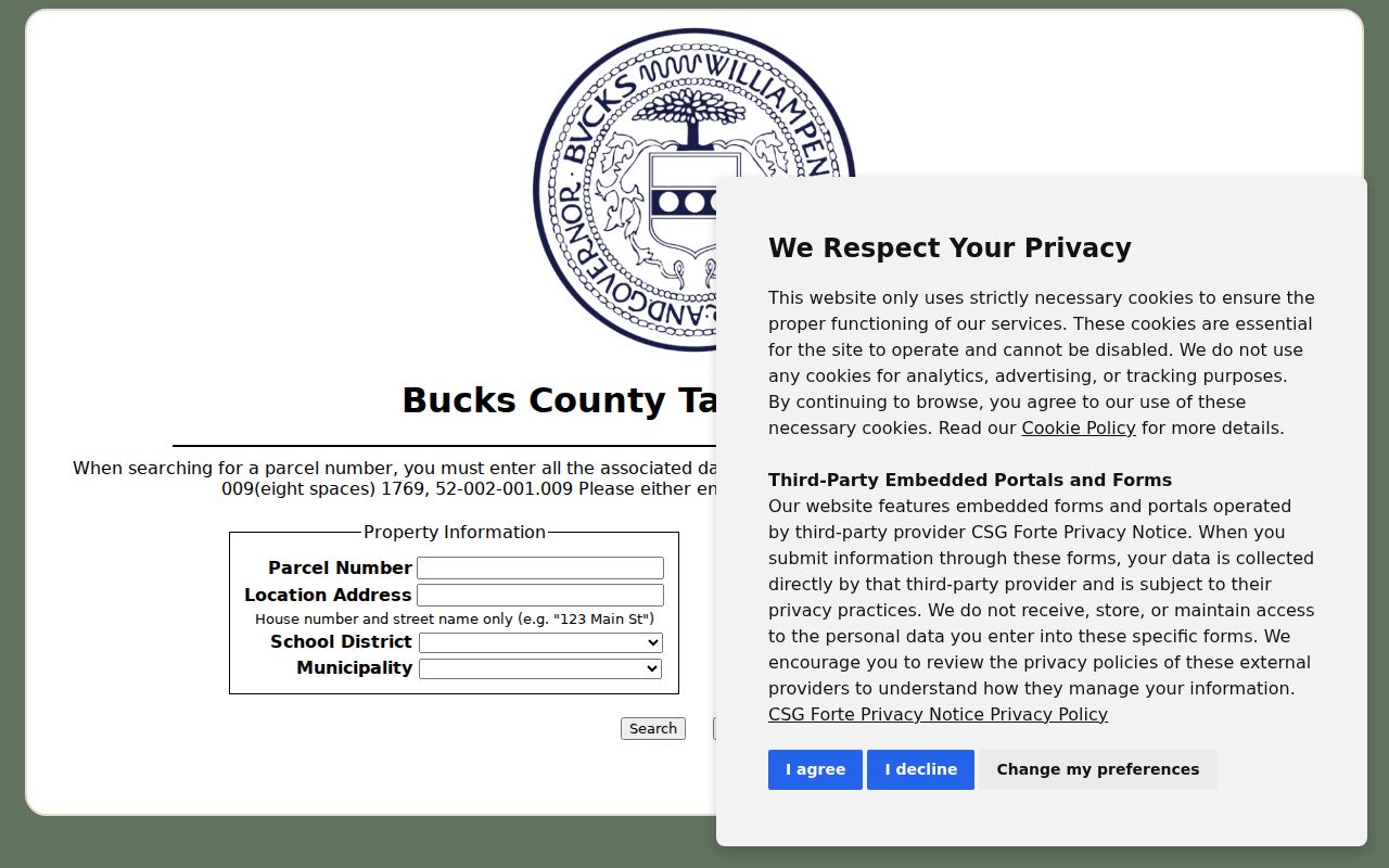
The separate Location Address, Mailing Address, City, and Zip Code fields are a reminder to preserve the property and tax-mailing details as different facts.
Bensalem Township Street Records Search Fields
A property search can be precise without claiming more than the form supports. The table lists the inspected Tax Claim fields that are relevant to a Bensalem Township street directory search. The form does not publish a historical index start year, an export control, a result limit, or an individual record-image policy. It is a current tax-information interface, so an older ownership question should move to the Recorder after the present parcel is identified.
| Field | How it is used | Format or boundary |
|---|---|---|
| Parcel Number | Strongest known-property key | One usable criterion is needed; include all dashes. |
| Location Address | Find the situs by house number and street | Enter the house number and street only. |
| Municipality | Set the civic jurisdiction | Select Bensalem Twp from the county list. |
| Name | Owner-information lead | Use last name first when possible. |
| Mailing Address, City, Zip Code | Narrow tax-mailing information | These fields can differ from the property location. |
| School District | Optional property filter | The form supplies a countywide dropdown. |
Tax-sale notices are a separate, event-specific source. The inspected public notices can show a control or parcel number, Township, property location, owner, property description, upset price, and, in final results, an outcome and purchase price. A tax-sale line documents that statutory event. It does not create a full ownership or occupancy history.
Note: Parcel-number syntax and the Bensalem Twp selector are stronger checks than a street name alone when several county records use a similar locality label.
Map a Bensalem Township Street Parcel Carefully
Bucks County Maps & Data and the county's published parcel layer help place an address among parcel outlines, road centerlines, and nearby lots. Browse to the address, identify the target boundary, and then verify the parcel identifier through the assessment or tax path. The map supplies geography. It does not independently establish ownership or a household.
The county-published Bucks parcels item is the source behind this Bensalem Township street directory map view.
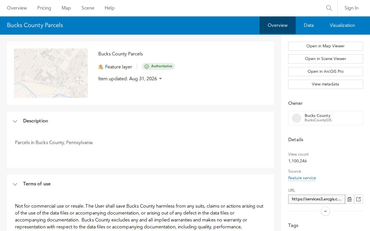
Use the visible boundary as an orientation aid, then pair it with the parcel number from a county record before drawing any conclusion.
The live viewer controls, full layer list, measurement tools, search controls, and exact pop-up fields did not render during the research session. No full GIS-control list is therefore claimed here. The supported process is map browsing followed by tax or assessment confirmation.
Bensalem Township Street Deed Trail
The Recorder is the address record's historical layer, but a street address is not always its primary index key. Start with the current owner from the parcel record, search that person as an indirect party or grantee, and use an approximate year. A deed's legal description can name a plan or lot, while the recital or being clause identifies predecessor sellers and a prior book and page or instrument reference. Follow that reference one document at a time.
Bucks County says its Recorder holdings run from 1684 to the present. Historic name indexes are divided into ten eras, from 1684–1919 through 1999–present, instead of one simple modern alphabetical list. This is the key numerical fact behind a careful Bensalem Township street directory trail: an older search needs a name and an estimated transaction period. Documents recorded after July 1, 2012 use an instrument number rather than a book and page citation.
The county-linked LANDEX service is the online access route for the Recorder's land records.

LANDEX offers Webstore for limited browser searching and online document payment, while Windows Remote is aimed at frequent users with time-and-page billing.
Paid online access is only one channel. The Recorder has a public research area, gives a short LANDEX tutorial, and may schedule a specialized appointment. Staff do not perform a title or historical search for the requester. For copies, call 215-348-6209 or mail the Recorder at 55 E. Court Street, Doylestown, with a self-addressed stamped envelope. The published price is $1 per page, certification adds $1.50, and plans cost $5 per sheet when available.
Bensalem Township Street Address Assignment
A new, split, or uncertain street number can require more than a parcel search. Bensalem Building and Planning's address-request procedure asks for one property per request, the tax parcel and lot, street, nearest intersection, adjacent house number, and a sketch showing north, south, and across-street addresses. That is a local records clue: a numbering question may need parcel and neighboring-number evidence, not just the street label.
The request is submitted to Building and Planning at 2400 Byberry Road or by email at permitcenter@bensalempa.gov. Its office-use path calls for review entries from Township Fire Rescue, Bucks County BOA, Bucks County 911, and the Post Office. The form explains how local addressing joins municipal, county, emergency-routing, and postal checks without treating any one of them as a complete resident record.
- Parcel
- A county identifier for a tract or property unit, used to connect tax, map, and assessment material.
- Situs address
- The physical property location, shown as Location Address on the county tax form.
- Plat or plan
- A recorded subdivision or survey reference that can keep a property trail stable when street details change.
- Criss-cross directory
- An address-arranged directory, useful only after a real local volume and its year are confirmed.
Bensalem Township Street Permit Files
Building and Planning handles permits, zoning applications, plans, inspections, code complaints, and address requests. It does not advertise a general searchable permit archive or a public resident roster. Make a focused inquiry by address or parcel and date range instead of seeking a broad list. A permit, zoning decision, or code file can show a project address, tax parcel, permit status, date, owner or applicant as filed, and the agency's review findings.
Those fields establish a dated administrative record, not every person connected with the property. Code Enforcement describes a process that can move from complaint to inspector visit, Notice of Violation to the property owner, possible citation and hearing, and, if needed, Township work and a lien. Cross-check an owner or transfer point against the Recorder rather than treating a permit addressee as a complete ownership chain.
For records that are not available through the ordinary forms channel, the Township's public-records route uses the Pennsylvania Right-to-Know Law. A precise request should name the address or parcel, date range, record category, and preferred electronic format. The RTKL default response period is five business days, subject to the extension rules in 65 P.S. § 67.902 and the fee rules in § 67.901.
Bensalem Township Street Directory Record Coverage
Each address-keyed source answers a different question. The coverage below keeps a Bensalem Township street directory search from turning a parcel, map, or document clue into an unsupported statement about a household.
| Address-keyed source | Starting key | Useful contribution | Important limit |
|---|---|---|---|
| Tax Claim Public Access | Parcel, address, name, municipality, mailing fields | Current property and tax context | No stated historic index and not an occupant list. |
| Assessment PAS | Live parcel or address route | Assessment and parcel-card context | Maintenance and update lag require care. |
| County GIS parcels | Map browse and parcel identification | Parcel outlines and adjacency | Geometry is not current resident proof. |
| Recorder and LANDEX | Party name and approximate year | Recorded chain and legal description | Paid online path; older indexes are era grouped. |
| Building and Planning | Parcel or address with date range | Permit, zoning, code, and address-request material | No public results database is confirmed. |
| Historic directory inquiry | Street or community name and year | Potential address-to-occupant lead from an actual volume | Bensalem reverse-directory years are not verified. |
Bensalem Township Street Postal Clues
A street address may have a Bensalem 19020 postal label or a Trevose 19053 postal label while still being within Bensalem Township. Bucks County polling-place rows use both postal designations for Township precincts. The municipal boundary and the delivery city are separate checks, so select Bensalem Twp in the tax form and verify a specific delivery address through USPS rather than relying on a ZIP alone.
Older work also benefits from historic community names. The Township's postal identity changed with a 1979 consolidation, while its borders did not change. Try Andalusia, Eddington, Cornwells Heights, Bridgewater, Flushing, Cornwells, and Trevose alongside Bensalem when an older deed, obituary, map, or directory index seems to miss a street. No Township-wide renumbering year was verified, so a broad renumbering claim would be unsupported.
For historic address material, the Bensalem Branch, Bensalem Historical Society, and Mercer Research Library are the route to ask about an actual dated volume. The historical collections themselves belong on the Bensalem Township city directory page; a street inquiry should supply the street, community label, date range, and a request to verify the volume title and notation key.
Bensalem Township Street Records Since 1684
The Recorder's property-records page documents the county's 1684-to-present holdings and the historical index eras used to reach older land records. Bound volumes are no longer the office's continuing format. The county uses microfiche, microfilm, and PDF/A, and its preservation work includes historic deed books that have been microfilmed. That means a thin online result does not end an older street inquiry.
The Bucks County Recorder property-records page describes the research-room, LANDEX, historic-index, telephone, and mail paths.
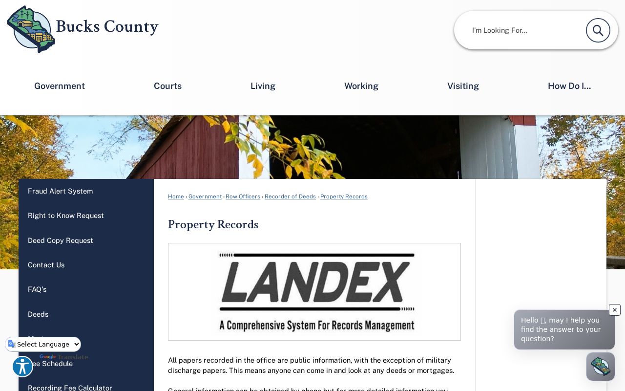
Use the historic index era, a party name, and an approximate transaction date before asking for research-room help, since staff can orient a search but do not conduct the historical work.
Limits of a Bensalem Township Street Directory
Parcel records document property, recorded deeds document transactions and parties, tax mailing fields document where tax-related mail goes, permits document an administrative project, and GIS shows parcel geography. None is a verified list of all residents at an address. Utility customer files and motor-vehicle address records are not public Bensalem Township street directory sources, and Pennsylvania's Driver's Privacy Protection Act restrictions and Safe at Home protections can limit expected information.
Use the record's own terms: owner, recorded party, tax-mailing contact, or permit applicant. Those labels are more accurate than assuming who lives at a property, and they preserve the limits built into the county and Township systems.